By Andrea Mauk|
Gesundheit Traveling Fellowship Blog
12/2024
Photography by Andrea Mauk and Mark Cruz
Four towns in eight days with two days set aside for travel: that was the plan. If we fell behind schedule, the entire trip would be thrown off, because every stop on our itinerary was consequential. That’s why we left Los Angeles at 2:00 A.M. and ventured towards Arizona on the 40 freeway, darkness obscuring every roadside detail. As the sun ascended over the mountains, California was only visible through the rearview mirror. Soon, road signs were tempting us to turn towards the Grand Canyon, but we stayed on course. We calculated that if we only stopped for gas, grocery store snacks, and ate on the run, we would make Durango, Colorado before nightfall. Northern Arizona bombarded us with scenic distractions from all sides, but we stayed our course.

Northern Arizona entertained us with red rock formations.
My companion and I had the option to fly, but we chose the classic road trip. Our desire was to best emulate the experience most travelers have while enroute to our destinations. Thanks to being chosen as the Gesundheit Family/USC Architectural Guild Traveling Fellowship recipient, I was on my way to visit two sets of remote mining towns that were thriving heritage tourism destinations. I wanted to explore the factors that help these former sites of extraction to draw enough visitors to survive when so many other locales have all but crumbled into oblivion.
I created a list of ten ingredients for my hypothesized recipe of creating a successful post-mining economy:
- A walkable, historic downtown filled with opportunities to shop, eat and absorb some history.
- An ample number of hotel rooms/lodging opportunities both historic and modern.
- A natural environment fit for recreational activities during multiple seasons (hiking trails, river, ski runs, etc…)
- Strong local governance that balances growth with preservation of the historic built environment and cultural heritage.
- Residential historic districts, where vintage homes help convey the period of significance of the town.
- Historically related public art
- Activated public spaces and third spaces (spaces outside of home and work – preferably free to use.)
- Regional attractions and reciprocal relationships with neighboring communities.
- Parking and accessible transportation.
- An aura of the Old West
South Durango’s modern cityscape is filled with apartments, condos, hotels and eateries. When driving through town, few clues reveal that Durango was home to the Ute, and long before, the Pueblo people who inhabited nearby Mesa Verde. Nor does the newer development hint that just down the road lies a delightful, historic smelting and railroad town. Durango, with a population of around 20,000 people, is developing in a similar way to the much larger Prescott, Arizona, which has a newer section, Prescott Valley, that is able to expand without threatening the integrity of the historic downtown. In both Durango and Prescott, the sections of town on the outskirts were planned to meet pressing housing and diversification needs.
Historic Downtown Durango runs along Main Avenue. Anchored by two grand, Victorian-era hotels, the General Palmer and the Strater, and the Durango & Silverton Narrow Gauge Railroad Depot on the south end, the area is pedestrian friendly. A mixture of high-end shops and galleries, and more locally oriented businesses such as a bike store, a local pharmacy and a used bookstore are present. Ghost signs, murals and word art help to express Durango’s history and culture, while dining spills out onto the sidewalks in front of many restaurants during warmer months. Dining appears to be a culture onto itself in Durango, as the town has, per capita, more restaurants than San Francisco!


Above: Deer grazing in Durango’s residential neighborhoods
Below: Colorful murals depict Durango then and now.
Everyone we met in Durango was from somewhere else, mostly California. The only locals we encountered were deer. They grazed in front yards and slept on porches. They appeared to be more plentiful than the fish in the Animas River that flows through town. The deer were prevalent in the all residential neighborhoods, with the East Third Avenue Historic District being no exception. The district teems with vernacular Victorian homes built of wood and brick. The area was designed with accessibility to neighbors in mind, so fences remain see-through and porches prominent. We noticed no homes for sale in the district which exhibited stability in the highly walkable neighborhood.

A two-story Queen Anne home in Durango’s historic district.
While the major economic driver in Durango is heritage tourism, healthcare, education, recreation and construction have all claimed a slice of the pie. Fort Lewis College is located up the hill from the historic district. The only four-year liberal arts campus in the Four Corners region employs around 600 full-time workers. The college is modern and spacious, with outstanding athletic facilities spread across the 362 acre campus. The public school district operates 14 schools and employs 845 people. Two hospital campuses employ approximately 1,100 workers. Purgatory, the local ski resort offers snow-season employment to 1000 people. The railroad, which provides transportation between Durango and Silverton, adds another 200 jobs. Local government employs another 550 people, Construction, real estate and business services are additional sectors where many Durango residents are employed, while ¼ of Durango residents work in food service and lodging. Even though Durango has an airport, it only creates about 21 full-time jobs. Durango has the most diversified economy of the destinations we visited.
We weren’t sure that taking the train to Silverton was the best use of our limited time, as a one-way trip from Durango took over three hours to complete. However, the train’s whistle continually coaxed us from just outside our hotel window deep into the evening. Finally settling on taking a 1 ½ hour guided bus ride to Silverton and a vintage narrow gauge train ride back, we went to bed early to save our energy for the next day’s adventures. If 245,000 passengers rode the Durango and Silverton rails in 2023, the trip must be worth its slow pace.
Mark, originally from Arizona, was the best bus-driving tour guide we’d ever encountered, and we were grateful for his superb multi-tasking skills as he explained how many vehicles slide off the side of the highway each week. There were no guard rails, as any type of barricade would block the snow from falling over the cliffs during winter storms. The danger was real, so he drove the bus slowly, pulling over occasionally to let faster vehicles pass. On our right were mansions, and on our left were the Trimble Natural Hot Springs that had been attracting visitors since the late 19th century. Clusters of cloned Aspen trees wore their dancing yellow leaves like Native American jingle dresses, each leaf attempting to hang on until winter’s first frigid blast came. The area between Durango and Silverton is unincorporated Hermosa, with its Durango zip code but not its higher taxes.
The mountain passes between Durango and Silverton are steep enough to make a person short of breath. Coal Bank Pass has an elevation of 10,640 feet, while Molas Pass tops out at 10, 970 feet. As the bus began its descent into the Baker’s Park valley, Silverton spread out before our eyes like a miniature model of a mining town. Silverton’s slight footprint was only exaggerated by the height of the surrounding peaks. The tour bus rolled over the town’s unpaved streets and came to a stop near where the railroad tracks disappeared. There was no historic depot, just the end of the line, and tour guide Mark announced which restaurants were favorites and which had chosen to close early in anticipation of the frigid winter season.
As we disembarked, an employee of the local gold mine flagged passengers to gather round her if they had paid for a tour. Others were anxious to get to their hotel where they would stay for the weekend. We set out to find a coffee shop so we could warm up before we hit the gravel roads with our cameras and our curiosity. It’s colder in Silverton than it is in Durango.
The entire town of Silverton is listed on the National Register of Historic Places. That isn’t to say that every building is old, or original, but overall, entering Silverton does feel like stepping back in time – if you are willing to ignore the modern cars filling the parking spaces. Mining tools, memorabilia and antiques that would have been used during the town’s historic period of significance decorated the exteriors of buildings and populated empty lots in artistic arrangements. Colorful paint jobs accentuated the façades of vintage buildings, while newer structures were clad in rustic, textured metals that offered a nod to the town’s gold and silver mining history. Public benches made of snowboards hinted that the towering mountain slopes surrounding us would soon be packed with white.
A 16-foot tall white statue of Christ stands on the foothills of Anvil Mountain. Constructed of Carrera Marble imported from Italy, Christ of the Mines was placed on the mountainside in 1958, when mines all over the region were closing. Soon after the statue’s arrival, a new tunnel opened, providing better access to Silverton’s Sunnyside Mine. The economy of the remote town began to flourish again under the watchful eyes of the towering statue. While Christ of the Pines watches the town’s business interests, Wolfie, a wolf dog born and orphaned on the mountain, came to town to protect the town’s residents and animals from wild intruders. Though Wolfie has now passed on, his memory is as alive as ever.

Greene Street, Silverton, CO.

An exterior store wall decorated with antique mining gear.
Silverton has one paved street that spans the length of the town: Greene Street. Home to the oldest hotel, government offices, shops and art galleries, Greene Street can keep visitors busy for a stretch of time, but it would be a shame to miss infamous Blair Street, which used to be filled with raucous miners gambling and drinking in the saloons, and cavorting with the women of ill-repute. To this day, the “Shady Lady” stands atop her balcony and greets the train with an inviting wave of her hand.
Our three hours in Silverton passed quickly. As the whistle beckoned us to board our train car, I told myself that we would return one day, and on that trip, we would stay at least one night in Silverton. The layover was enough time to make a mental map of the town, explore a bit, and have a meal, but we hadn’t managed to venture beyond the throngs of tourists that came in on each train. We would soon discover that Silverton was the winner between the four towns we visited when it came to having recreational opportunities and activated public spaces that acted as third spaces. Two ski areas, lakes, trails, and the river offer endless adventure. A public stage offers a venue for summer concerts under the stars. Harmony Park offers kids of all ages experiential learning as they play the oversized harp and vibraphone.
The vintage narrow gauge train car wasn’t full when we pulled out of the station. We noticed that the seats on the left had sold out quickly, so we assumed the better view would be on that side, however, at the beginning of the trip, the Animas River’s turquoise waters flowed to the right of the train. I moved to an empty seat and watched the river wind through the valley as the pine-filled peaks on either side of the train grew to towering heights. The river meandered to offer the other side of the train car the superior view. Sometimes, the rocks were so close to the train car that it created a sense of claustrophobia, while occasionally, the drop off to the river became so steep that passengers reflexively leaned away from the open windows.

The vintage narrow gauge train pulling out of town towards Durango.

The views from the train are superb.
As we approached Durango, we noticed people running outside to wave at the train. Apparently, it is a tradition they cherish. Soon, we would be back at our room at the Strater Hotel, packing to leave for South Dakota before sunrise. We found it impossible not to marvel at the train ride and how it connects Durango and Silverton in a delightfully symbiotic relationship. I realized how much detail we miss by continually rushing from place to place. Maybe that’s why we found a scenic pullout early in our trip to South Dakota and took the time to stare at the stars we never see in the Los Angeles sky.
We traveled through picturesque farmland in Central Colorado, scenes painted in watercolor against the horizon. Then came Denver, where traffic was inescapable, and drivers tended to tailgate and then pull off to the side rather than hitting their brakes to avoid a collision. After a quick stop at a convenience store for snacks, we pushed on towards Wyoming, where land drained of pigment stretched beyond eternity. Occasionally, there was a house. Mostly, there were herds of livestock and snow fences standing at attention in preparation for winter’s arrival. Signs warned that in inclement weather the route we were traveling would not be open. The roadside was dotted with carcasses where deer and big rigs had met under unfortunate circumstances. Each tiny town we entered had a squad car waiting to greet speeders but no gas station, and as the needle on our gas gauge crept lower, our rental Rav 4’s entertainment system made a creepy comment about how many gas stations there were in Fort Collins, Colorado, as if it was scoffing at us.
After finding a Maverik station in Newcastle, Wyoming, we were able to relax and drive the 85 remaining miles through the Black Hills National Forest in peace. We drove through Lead (rhymes with steed) to arrive at our Sheraton Hotel in Deadwood. My friend, who had skipped a trip to Las Vegas to make the road trip with me, was pleased to see that Deadwood’s Historic Main Street looked like a mini Vegas steeped in a turn-of-the-century Western facade. We were beat, but we managed to check in to our room and then drag ourselves across the street to order appetizers at one of the local watering holes.
There, over buffalo wings and fish & chips, we befriended our server, Jessica, someone I felt I had always known. She informed us that most people working in town were transplants. She was from New York City. She also told us that her commute to work was about an hour, as there was no local available housing. Housing seems to be a problem everywhere, urban or rural backdrop, small town or metropolis. Lead and Deadwood were building new homes priced with the service sector workforce in mind. The homes are located in nearby towns, built through a local community land trust that also helps current owners rehabilitate their vintage homes.
Early the next morning, we began surveying the residential neighborhoods of Deadwood, and due to proximity, we were able to do the same in Lead during the afternoon. Both towns’ homes were built on hilly terrain, and reflect the vernacular architectural style popular at the time the towns were developed. In Deadwood, we encountered an apple tree that was dropping its fruit by the bushel. We also crossed paths with a flock of turkeys who remained unflappable when I warned them that November was just around the corner. In Lead, we discovered through commemorative signage, the “historical” Italian neighborhood and the “historical” English neighborhood, which would lead me to believe that miners lived in segregated areas. After digging for more information, I realized that the mine workers may have simply chosen to live near people with similar backgrounds and customs since no one ever complained bout the arrangement.

Main Street at dusk, Deadwood, SD.
Deadwood built its reputation on outlaws, murder and prostitution. When the last brothels closed in 1980, Deadwood lost its purpose for being. The eventual legalization of gambling saved the town. It is the murder of Wild Bill Hickok that continues to capture the imagination of visitors to Saloon #10 and the Wild Bill Bar. Costumed performers reenact the gunfight that took Bill Hickok’s life on Main Street in 1876. The Mount Moriah Cemetery where Wild Bill, Calamity Jane and U.S. Marshall Seth Bullock are interred attracts countless visitors. Deadwood does an excellent job representing its sordid history, but as Tripp, the bartender at the Wild Bill Bar explains, “The town burned in 1879, so little of this is authentic,” as he serves a patron up a shot of low-proof whiskey that is a facsimile of what was served in the late 1800s.
Losing the historic fiber of the town didn’t stop Deadwood from building back better. The town has over 1,500 hotel rooms, multiple meeting rooms and convention facilities, a concert venue, a $2.00 trolley that has a GIS Tracker app, a 411-vehicle parking garage located one block off Main Street, sports betting (since 2020) and limited-stakes slot machines, poker and blackjack 24 hours a day. Public parks, hiking trails, campgrounds and fishing are available for those who love the outdoors. The regional hospital is located in Deadwood.
Deadwood doesn’t have everything, though. The full-service grocery store, Lynn’s Dakota Mart, is located in Lead, along with several gas stations (which we learned the importance of back in Wyoming) and the Black Hills only ski resort. While we were there, it was difficult to access the downtown due to road construction, but we drove the winding residential roads until we found our way to Main Street. In every way that Deadwood is highly costumed, Lead appears comfortable with its subtle gold mining town identity.

A residential street in Deadwood.
The Homestake Mine was established by the French-Canadian Manuel Brothers, and then sold to George Hearst (father of William Randolph Hearst) and his partners. The gold was plentiful at Homestake, so the company could afford to be good employers. George’s wife, Phoebe, lovingly helped to create a town that could be a real home to the many immigrant miners that worked there.
Lead’s Homestake Mine produced gold for over a century. It was the deepest and largest underground and open pit gold mine in the Western Hemisphere. When mining ceased at Homestake in 2002 leaving a company town without a company, many residents moved away in search of new jobs. Logic would tell me that the huge open cut would remain a prominent scar on Lead’s landscape forever, but then something amazing happened. The open cut gained a new purpose as SURF, the Sanford Underground Research Facility. Slowly, mine employees began to return to Lead to assume new roles at the Sanford Lab. When I discovered what was happening in Lead through reading an article in Landscape Architecture Magazine, the universe inside my head exploded with possibilities. While the scientists in tunnels as low as 8000 feet below ground were studying dark matter and neutrinos, and wondering why positively and negatively charged matter didn’t cancel each other out, therefore allowing life on the planet to take hold, I was imagining that there must be many more uses for abandoned open pit mines that no one has even thought about yet. That idea was mind boggling!

The layers of the Open Cut are visible in many areas of Lead.
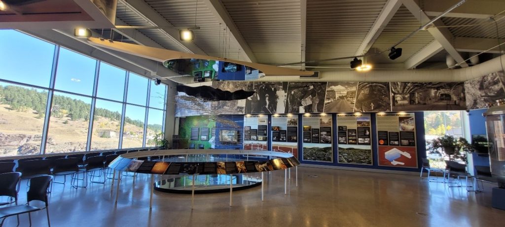
Displays in the lobby of the Sanford Lab explain what the scientists are
studying deep underground.

Manuel Brothers Park explains Lead’s early mining history
in creative, family-friendly ways.
Lead was the only town where we met locals who grew up there, and who exude a sense of pride and neighborliness that is also commonly found in Southwestern mining towns we’d previously visited. As is typical of frontier towns built from wood, there was a fire in 1900 that burned most of downtown. In the 1920s and 30s, the land around the open cut became unstable, so part of the downtown and parts of residential neighborhoods were relocated. When the mine closed, the land surrounding the cut was transformed into the Manuel Brothers Park. A mural and reused mining equipment help to tell part of the town’s history. Recreational areas include tennis and pickleball courts, a horseshoe area, basketball facilities, a splash pad, picnic areas and more.
Since Lead and Deadwood are so close together, it allowed us half a day to visit other sites. With a variety to choose from, we ventured to Mount Rushmore and Rapid City. It was there, in the downtown area, that we realized we had managed to transport ourselves to the Midwest, and we had a long drive home facing us. Just as I began to doubt the wisdom of driving so many miles, we approached Monument Valley, Arizona, at sunset and watched nature wash the rock formations with unimaginable brilliance. What does one do after such an experience? Push forward to the next destination, Kayenta, for Navajo tacos and a good night’s rest.

Monument Valley, Arizona. Nature is the most prolific architect.
- – –
The thrill of the great American Road Trip cannot be denied. Every year, thousands of people hit the backroads and two-lane highways in search of discovering Americana, vestiges of the Wild West, and what they seek exists in our former industrial towns if they choose to highlight their history, tell their entire stories, create new traditions, keep regular hours, and bill themselves as destinations rather than pit stops. The four former mining towns we visited exhibited amazing resilience in finding ways to thrive after their initial industries related to extraction died. Currently, all four places we visited are growing. For some towns, transformation will be a true challenge, but even if the road towards economic survival seems light years away, with a little imagination and a ton of persistence, it’s possible to find the perfect path.